PASSCAL supports Salton Seismic Imaging Project (SSIP)
Six PASSCAL staff members were in Southern California this March to support the Salton Seismic Imaging Project (SSIP). The project is funded by NSF through both the MARGINS Program (now GeoPRISMS) and the EarthScope Program, and funded by the U. S. Geological Survey through the Multi-Hazards Demonstration Project. The project includes researchers from Virginia Tech, Caltech, the USGS, and Mexican partner institutions CICESE and UABC, Mexicali.
The project is complemented by an ocean bottom seismometer deployment in the Salton Sea (Scripps Institution of Oceanography and the University of Nevada, Reno) and a land broadband seismometer deployment across the southern Salton Trough (Stanford University). Principal Investigators include John Hole (Virginia Tech), Joann Stock (Caltech), Gary Fuis & Michael Rymer (USGS Menlo Park), and Antonio Gonzalez-Fernandez (CICESE, Mexico).
A major goal of the project is to help geoscientists understand the structure of the Earth in the area around the San Andreas Fault, including the sedimentary basins on which
many cities are located.
|
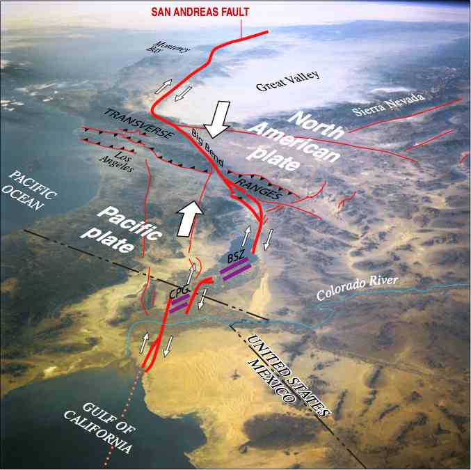
Southern California consists of two of Earth's plates (the Pacific and North American plates) moving past each other. The boundary between the two plates is quite crooked. Heavy red lines indicate the San Andreas and related faults. As the two plates move past each other along these faults (in the directions of the small white arrows), earthquakes occur. The purple lines indicate locations between these faults where the Earth is being pulled apart, creating a deep valley or even new ocean. Volcanoes and underground magma in these areas create geothermal energy and hot springs (CPG is Cerro Prieto Geothermal area; BSZ is Brawley Seismic Zone and geothermal area). (Courtesy USGS) |
 |
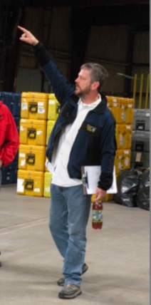 |
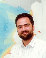
John Hole of Virginia Tech directs unpacking of the shipment from PASSCAL. |
|
Joann Stock of Caltech brought along a fleet of vehicles for the deployments. |
 |
 |
Antonio González Fernández of CICESE coordinated the stations deployed in Mexico. (Courtesy CICESE). |
|
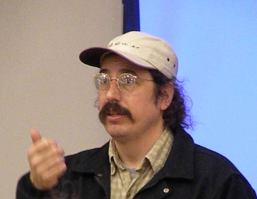
Basil Tikoff, from the University of Wisconsin, was the leader of the North team (in Indio), and also helped out at the El Centro base. |
 |
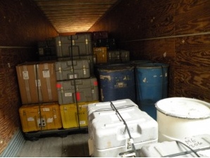 |
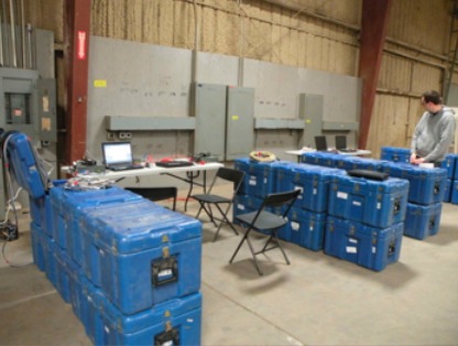
A truckload of sensors and equipment awaits unloading. |
|
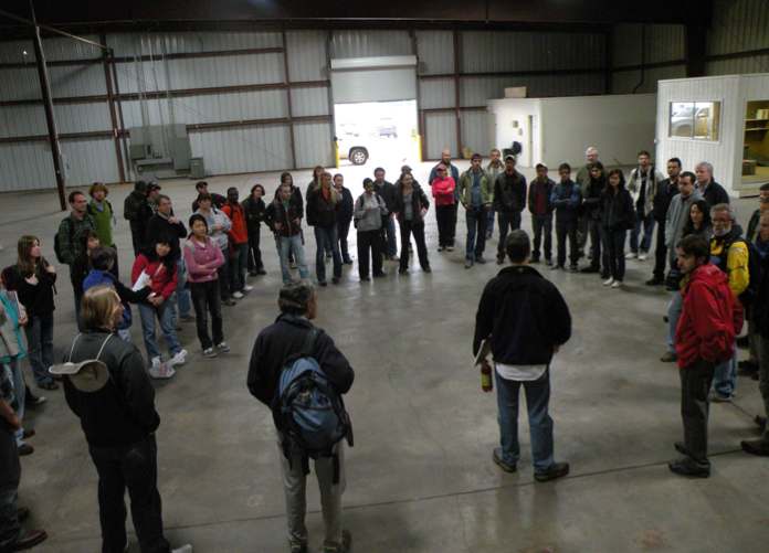
John Hole briefs the deployment team at the first-day Orientation meeting. |
 |
 |
Patrick Bastien of PASSCAL prepares to batch-program hundreds of "Texan" digitizers. |
|
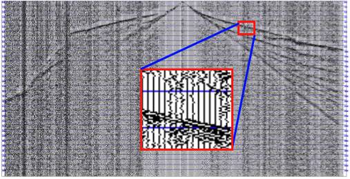
This "Gather" plot from the Salton Trough data indicates subsurface geometry. The horizontal axis represents distance from the location of the active source (at the center of the diagram). The vertical axis represents time after the shot; the two-way reflection times are strongly affected by density or material changes underground, and thus can be used to deduce the depth of subsurface features. In particular, changes of slope of the reflected waves are related to depths of underground structures. |
 |
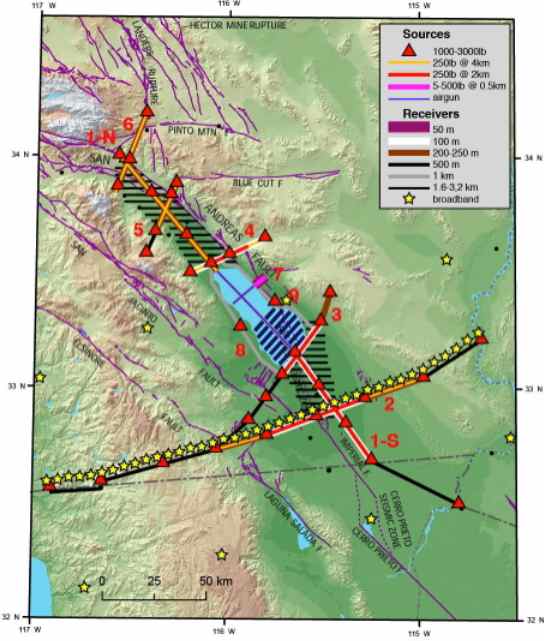 |
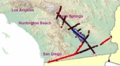
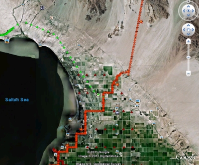
Layout of Salton Seismic Imaging Project (SSIP). The gray triangles indicate larger shots. Smaller shots are located at 1.2- to 2.5-mi spacing along the red and yellow lines, and seismographs are located at 325- to 650-ft spacing along red, yellow, and black lines. (Courtesy USGS) |
|
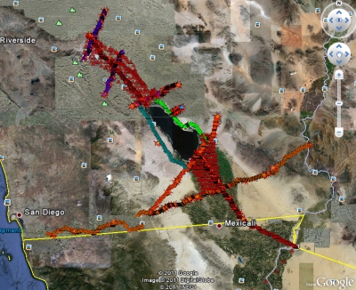
From our Google Earth KMZ File (628 kb) |
From our Google Earth KMZ File (628 kb) |
The Salton Seismic Imaging Project (SSIP) will produce detailed images of underground stuctures and sediments in the Imperial and Coachella Valleys, and adjacent mountain ranges as well. The images will be studied to better understand earthquake hazards in Southern California. They will be used to determine the subsurface geometry of the San Andreas Fault, the depth of associated sediments, and the speed that earthquake energy can travel through the soil. These factors all affect how much the earth shakes during a severe earthquake. A better understanding of earthquake locations and shaking amplitudes will allow buildings to be better designed or retrofitted for resistance to seismic damage. Additionally, emergency plans for dealing with severe quakes in this area can be improved.
This material is based upon work supported by the National Science Foundation under Grant No. 0742263.
For more on SSIP, see:
- Earthscope page on the Salton Seismic Imaging Project (SSIP)
- Dr Mouse's Adventures in Science (PASSCAL's Dr. Mouse Reusch's SSIP blog)
Except where noted, images courtesy of Dr. Mouse Reusch of PASSCAL.
