Ground Penetrating Radar (GPR) System

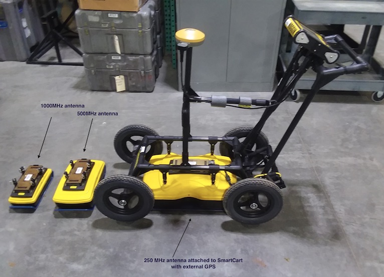
The IRIS Education and Public Outreach program acquired a Sensors and Software Noggin GPR System with SmartCart configuration to enhance the IRIS PASSCAL equipment pool (see image at left). The system has onboard GPS, data acquisition programming, and preliminary data interpretation capabilities. The system has both line-scan or grid-scan data collection modes. The onboard software allows for quick survey setup, on-the-go viewing of the waveforms collected, and initial waveform depth estimates. Processed onboard data can be visualized as depth versus position along a line, or as a slice view of grid data. The PASSCAL Instrument Center offers additional software for more in-depth post acquisition processing and interpretation of the data.
The Noggin has 3 sets of transmitter/receiver antennae (1000, 500, and 250MHz) for near surface GPR investigations. Example uses include hydrology, engineering, archaeology, and teaching projects. The three different antennae frequencies allow for a trade-off between depth of penetration and resolution. Depth of penetration is greatest using the 250MHz antenna and least with the 1000MHz antenna. The resolution is greatest using the 1000MHz antenna and least with the 250MHz antenna.
