Installing a "Cold and Dark" Seismic Station in the Yukon
On October 8-13, 2012, a three-man team from the EarthScope Transportable Array and IRIS/PASSCAL installed a prototype "cold and dark" seismic station at Eagle Plains, Yukon Territory, Canada, just 30km south of the Arctic Circle. The station installation developed new methodologies for drilling a shallow, 55" deep borehole in exposed bedrock. Protection for electronics, power, and communication subsystems (from the elements, and from large wildlife) was provided by an all-weather hut bolted to bedrock.
The late-season install required 2 days of driving north from Whitehorse, Canada, along the Dempster Highway. Eagle Plains is a remote outpost in the wilderness, consisting of a hotel and diesel repair facilities for truckers and tourists stranded by bad weather. Temperatures on-site rarely rose above 10oF, but the long nights provided many opportunities to observe magnificent aurora borealis.
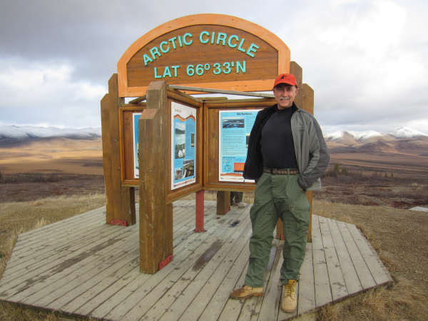 |
On the way to Eagle Plains, Shane Ingate of IRIS/PASSCAL marks the team's arrival at the Arctic Circle. |
|
At right: Allan Sauter of IRIS/PASSCAL and Mike Couch of Earthscope/TA.
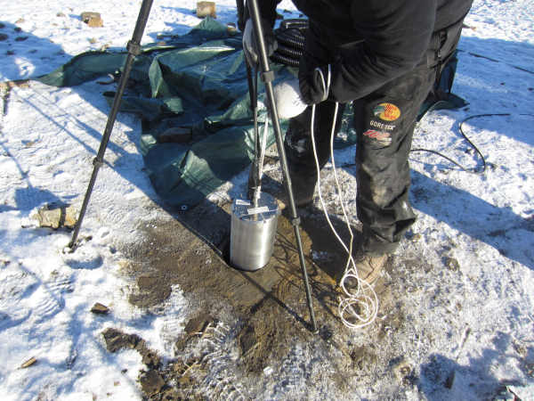
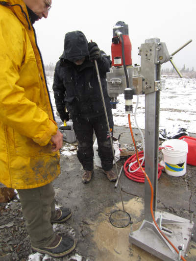
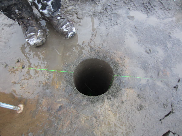
One day was spent preparing the site and drilling the sensor borehole using core drilling equipment designed for concrete work. A Multiwave Azimuth Pointing System using differential GPS allowed for the Nanometrics 120PH borehole broadband seismometer to be correctly oriented at depth. An onboard, self-leveling gimbal system provided final leveling for the seismometer. Site preparation took just over four hours; two hours of this time was spent waiting for the drill's anchor epoxy to cure. The actual drilling time was 57 minutes, at a rate of 1"/min. The rate would be less for non-eroded igneous or metamorphic rock. Much more time was spent removing the cores than for the actual drilling. When the drilling was finished, the rig was packed away, and the borehole was ready for sand and the sensor. Once the sensor was placed down the borehole, fiberglass insulation was added, and the hole was covered with a concrete cap. Data transmission is via FreeWave RF radio to the nearby settlement, and from there, a dedicated DSL line over microwave link inserts the waveform data into the internet. |
 |
 |
At left, Mike Couch adjusts the APS (Azimuth Pointing System) used to orient the sensor within the borehole. |
|
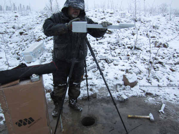
A Laser lights the way for proper orientation. |
 |
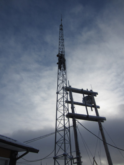 |
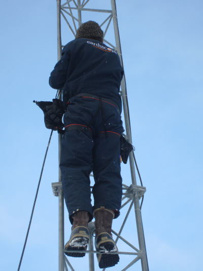
At left, IRIS/PASSCAL's plucky Allan Sauter climbs a tall tower to deploy the antenna system. |
|
At right, Allan is glad to return safely to earth. (Note the snow on his boots!) |
 |
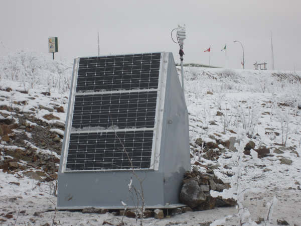 |
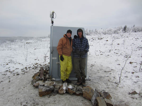
The final phase of construction was installing the hut. Bolted to bedrock and populated with over 500 lbs of batteries and electronics, the hut is intended to provide protection from curious bears, heavy snow and high winds. A GPS antenna and a weather station were bolted to the outside of the hut. |
|
At right, Shane Ingate and Allan Sauter of IRIS/PASSCAL stand in front of the finished Plaschem hut. The path of rocks is protecting the sensor cable. |
 |
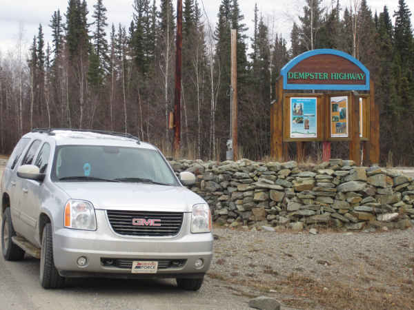 |
Upon completion of the installation, the team heads back home via the Dempster Highway, made infamous by the TV series "Ice Road Truckers."
The station equipment was purchased by the Yukon Territory Geological Service, and was installed by TA and PASSCAL staff. |
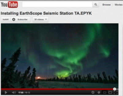
Shane Ingate has produced a video which shows the complete installation of the sensor down the borehole. Click here to view it on YouTube, or click here for full-screen mode.
Click on any of the links below to see specific parts of the installation.
October 8th – 00:00
00:15 : Setting up the borehole drilling rig
00:42 : Setting anchor stud for the drill press
01:24 : Assembly and leveling of the drill press
02:48 : Drilling the borehole commences
03:00 : Wet/dry vacuum to take away excess water
03:10 : Drill depth is 18 inches; core extraction
03:50 : Drilling Session #2
04:12 : Borehole now at 36 inches; extracting core
05:05 : Drilling Session #3
05:31 : Extracting the core
06:06 : Final drilling session
06:32 : Target depth at 55 inches, extracting core and debris
07:42 : Setting up the APS (Azimuth Positioning System)
October 10th – 08:20
08:20 : Sensor installation – Nanometrics Borehole Broadband
08:53 : Using APS to find True North
09:35 : Covering sensor with sand
09:47 : End-to-end system test with power, sensor, DAS, VIE and communications
10:52 : Insulating upper part of borehole with fiberglass
11:00 : Installing the cement plug on top of the borehole
October 13th – 11:43
11:46 : Installing Plaschem hut for DAS, etc.
12:17 : Installing anchor bolts for hut
13:34 : Building mast for WX and GPS
13:56 : Populating hut with VIE, DAS, batteries, etc.
17:15 : Protecting sensor cable with rocks
17:49 : Aurora borealis seen at Eagle Plains, YT
