PASSCAL and EMRTC help BBC explain internal structure of Earth
In early May, a team from the British Broadcasting Corporation (BBC) visited New Mexico Tech to use school facilities to support a new documentary on the current state of knowledge about the Earth's core. Since seismology is the only practical method for probing the Earth's core, the team arranged the support of two of New Mexico Tech's facilities, the Energetic Materials Research and Testing Center (EMRTC), and the Program for Array Seismic Studies of the Continental Lithosphere (PASSCAL), to demonstrate how the seismic waves from earthquakes or man-made explosions can travel through the Earth, and be used as a subsurface probing tool. The team was assisted by Dave Thomas and Mouse Reusch from PASSCAL, and Richard Aster from the NMT Earth and Environmental Science department.
|
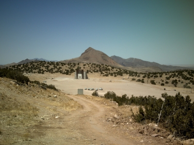
EMRTC's HPM (High Performance Magazine) Facility was the site of "Ground Zero" for the demonstration blast. |
 |
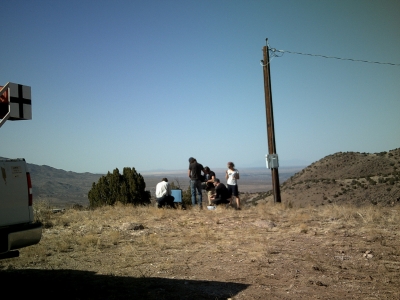 |
The BBC crew observes Rick Aster setting up a seismic station 2 kilometers from Ground Zero. |
|
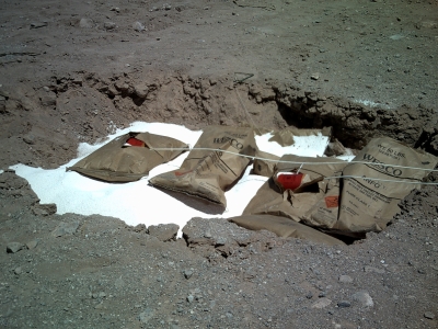
Before the Shot: 2,000 pounds of Ammonium Nitrate Fuel Oil (ANFO) are prepared for the upcoming blast. |
 |
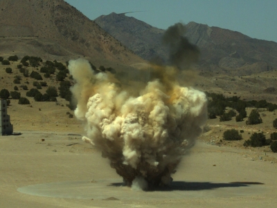 |
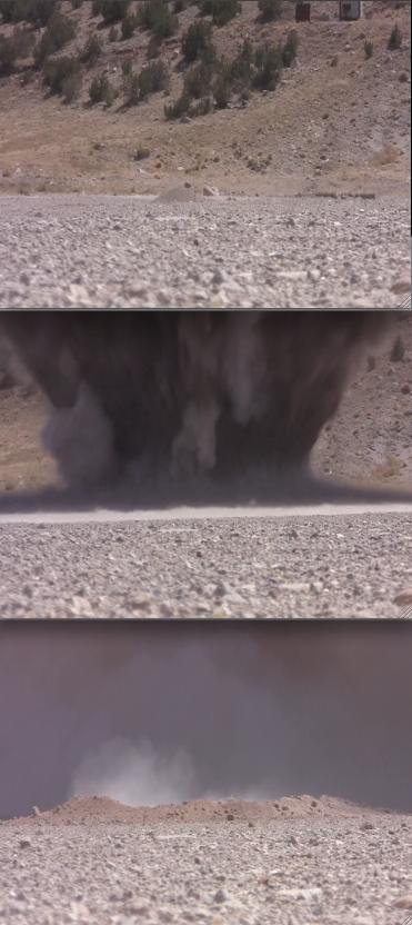
The upcoming BBC documentary will feature several high-speed films of the explosion. In this still frame, the overpressure shockwave can be observed spreading out on the ground, and in the air above the blast via atmospheric lensing. |
|
In this sequence at Ground Zero, the explosion produces a large crater. |
 |
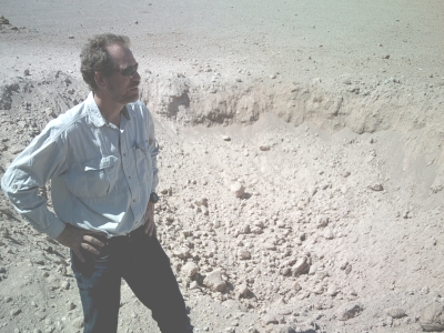 |
NM Tech geologist Rick Aster surveys the crater post-explosion. Aster was interviewed at length by the BBC in regard to how seismic waves can inform scientists about subsurface structures, how fast and far the waves can travel, and what type of sources are required to penetrate thousands of kilometers to the Earth's core. |
|
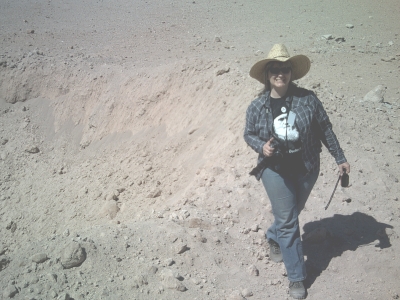
PASSCAL's Mouse Reusch gives the crater a "thumbs up." |
 |
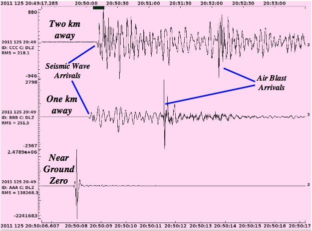 |
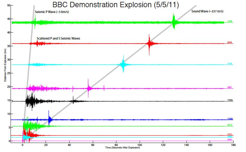
This seismic plot shows the seismic waves measured near Ground Zero (bottom trace), and at the seismic stations one and two kilometers away (middle and upper traces). The plot shows how the seismic waves travel much faster than the air-borne sound waves from the blast, and how the higher-frequency portions of the signals are attenuated as they propagate underground. Aster explained to the BBC how data from many hundreds of stations could be combined to yield images of subsurface structures. |
|
This record section shows how the fast-moving primary and secondary seismic waves (P, S waves) can be tracked with area seismic network sensors out to over 40 kilometers away, as can the slower sound waves from the air blast. Click here or on the image for a larger view. |
 |
Look for the final product in a few months. An American version of the documentary is being planned by the Discovery Channel.
