TA Installation in Alaska Now Complete
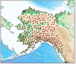
 After covering the lower 48 United States from coast to coast with a grid of nearly 1700 sites, the last seismic station of the EarthScope Transportable Array has finally been installed in Alaska. IRIS has commemorated the event with a post titled "EarthScope’s Transportable Array Spans Alaska, the Last Frontier." The IRIS article includes a detailed map of the Alaska TA stations, highlighting the location of the final station A19K.
Science Magazine also reported on the achievement in its October 6th, 2017 issue. The article, "Seismic array shifts to Alaska by Julia Rosen, notes
As fall takes hold, it's getting darker in Alaska. But underneath the state, the lights just turned on. On 27 September, near the coastal city of Wainwright, the last of 193 seismic stations was installed—completing a grid of 280 instruments that stretches across Alaska and northwest Canada, and kicking off the final phase of the USArray project.
...
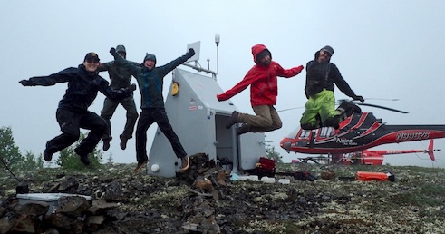
Moving the array to Alaska wasn't easy. Stations had to be outfitted with banks of batteries for storing solar power through the long, dark Arctic winter. And because many stations lay in rugged terrain beyond roads, they could not be buried using a backhoe. Instead, only the seismometers went in drilled holes in the ground, and the other hardware was packed inside refrigerator-sized sheds that could be suspended from helicopters and plopped down in far-flung spots. “We have to flip a few switches, and plug some cables in, but it's basically ready to go,” says Robert Busby, who manages the array for the Incorporated Research Institutions for Seismology, the Washington, D.C.-based organization that operates USArray for the National Science Foundation (NSF).
With the $40 million project in place, scientists will begin to examine one of the most active subduction zones on the planet, where the Pacific Ocean's tectonic plate dives under North America's in a grinding collision that generates earthquakes and volcanoes.
The PASSCAL Instrument Center houses the Transportable Array Coordinating Office (TACO) and the Earthscope USArray Array Operation Facility (AOF). IRIS/PASSCAL has supported the Transportable Array for the last fourteen years, and is pleased to add to the recognition of this important milestone. Read more about USArray here, and Transportable Array here.
- Home
- General Information
- Instrumentation
- Dataloggers
- Sensors
- All-In-One Systems
- Power Systems
- Field Procedures
- Controlled Sources
- Seismic Source Facility
- Magnetotelluric Systems at PASSCAL
- Ground Penetrating Radar
- Power and Memory Calculations Form
- Data Archiving
- Apply for a PI Account
- Experiment Scheduling
- Polar
- Important Hardware/Software Notes
- USArray
- Software


